|
The
Salt Lake
Salt lake which is also known as Qom and Kashan Lake is a large
evaporizing basin with an area of 2725
square kilometers, 765 meters above the sea level.
From the geomorphological point of view, this area is considered a
large playa which is surrounded by
numerous heights from all sides. These heights are followed by
mountainside regions and then large alluvial
plains not too steep which extend to the center of the basin.
In this playa, in addition to the main basin of Salt lake, two
smaller basins are observed west of the basin. One
of these small playas which is larger than the other is known as
Hoz-ol-Sultan basin. In fact all three basins
are from one origin forming one single playa, but for unknown
reasons these two have been separated from
Salt lake. Many rivers and creeks pour into the salt lake including
all seasonal rivers of
Tehran
from the north
and from the west.
Karaj,
Shur, Gharachai, Qomrood and many other rivers pour into this basin.
The
sediments which pour into the center of the basin come in three
categories which have affected the
morphology of the basin. These sediments include:
-
Mountainside sediments which are produced as a result of the
erosion of heights around the playa. This part
is the steepest part of the playa and is formed of small and large
granules.
-
The sediments of the nearby plains of the playa which are alluvial
and have been transferred from the nearby
heights. This part which is not very steep extends to the center
of the basin. The rivers which cross this part
and reach the center of the basin have produced many terraces in it,
and so river terrace sediments are also
found here.
- Playa sediments, which are often a combination of small granule
destructive sediments including clay earth
and other sediments like salt, plaster and similar particles. This
part is totally flat. The southern border of the
Salt lake's playa basin extends to the igneous belt which extends
from Azarbaijan to Baluchestan, from
northwestern Iran to the southeast.
This igneous belt has produced a series of continental sedimental
basins in the north which are often of the
kind of desert or salt basins appearing in the form of numerous
deserts and saharas. Many salt mines exist in
the suburbs of this lake. Those mines also appear in the form of
salt crystals which are processed and
powdered.
The Silk Road, a formerly major trade artery between the east and
west, was constructed during the early
years of the rule of Hann dynasty who ruled China from 207 BC to 220
AD. Until the 4th century AD, the road
was of great importance.
The origination of the Silk Road matched with the driving to power
of
the Arsacide
dynasty. Thus, the rivalry of
the two major empires of Iran and Rome caused the two fight several
wars.
In 476, with the collapse of the Roman empire, the trade on the Silk
Road was restricted to the Eastern Roman
district.
After the accession to throne of
Sassanids,
Iran
produced textiles and sold them to the Eastern Roman
empire.
At that time, the Iranians had dominated the silk trade and
protected the trade routes from western China and
the marine routes of Ceylon (Sri Lanka) to the
Persian Gulf.
The traders and political envoys of Venice and Genoa repeatedly
travelled to Iranian towns especially to
Tabriz
via the Silk Road. Until the 1390s, the route was open to
travellers. After the break-out of the One
Hundred Year Wars in Europe, the traders sought out an alternative
way. Thus, the Silk Road was
forgotten.
In the mid-fifteenth century, Tamerlane destroyed all the buildings
of the Silk Road. Even the attempts of
Safavid
ruler, Shah Abbas I, could not revive trade on the old route.
Generally speaking, the marine section of the Silk Road outstripped
its ground route in importance. Since the
might and power of the ancient Iran mainly concentrated in the sea.
In fact the Persian Gulf and other seas
made it possible for the Iranians to have a direct control and
supervision on the Silk Road.
According to a survey carried out jointly by the United Nations
Development Program (UNDP) and the
Conference of Trade and Development, during the full power of the
Roman empire in 200 AD, the length
of the
route amounted to 13 thousand kilometers, stretched from Karis in
the Atlantic Ocean to the port of
Shanghai
in China. The road progressed from Rome to Epin, Brandizim and
Ankara where it stretched
from
Tehran
to
Mashhad,
Bokhara, Samarqand and Farqaneh in the Central Asia. The next
destination of the route was
Kashghar along the Taklamakan Desert. From there, it proceeded to
Suzhu through the Jad
Gate and
reached the great China Wall, Ziyan and Shanghai in the Pacific
Ocean.
Rivers
and Water Basins in Iran
Rivers in
Iran
are classified into two categories:
- Permanent rivers
- Temporary or seasonal rivers.
Rain, Snow and Ice Feed Rivers in Northern and Western Iran.
During winter and spring, rivers are filled with water and in summer
this trend reduces. Most rivers in Iran are
steep and torrential because they cross mountains.The rivers in
Iran
have a saline characteristic. Many rivers
in Iran cross saline lands and are contaminated with all kinds of
substances and salt. In some areas the river
water penetrates into the ground producing swamps.
Karoun is the only river in
Iran
where ships can sail.
Flow - wise, the rivers in
Iran
come in 3 categories:
1- Permanent rivers which originate from Alborz mountains and flow
into the
Caspian sea.
2- Rivers which originate from Zagros mountains and flow into the
Persian Gulf
when merged with the
western rivers.
3- Low output rivers which flow across
Iran
and pour into swamps and lakes.
Iran's water shed basins include:
1- The
Caspian sea
2- The
Persian Gulf
and
Oman sea
3- Internal and borderline water shed basins
1. The
Caspian sea
water shed basin is a large and deep ditch, into which all the
waters of the northern skirts
of Alborz flow. The area of this basin is 256,000 square kilometers.
The most important rivers which flow into
this basin include Aras, Atrak, Gorgan, Chalus, Haraz, Tajan and
Zanjanchai.
2.The
Persian Gulf
and
Oman sea
basin
The
Persian Gulf
is a large ditch with an area of 224,000 square kilometers located
in southern Iran. The
major rivers which flow into it include Arvand, Gamasb, Karoun,
Jarahi, Zohreh, Sarbaz, Minab and Hendijan.
The northwestern rivers like Karoun which flow from the Zagros
mountain range are large and permanent,
whereas we observe smaller outlets on the coasts of
Oman sea
and part of the
Persian Gulf
because of lower
Political
Structure
Official Title: Islamic Republic of
Iran
International Title: Islamic Republic of Iran
International Title in the past: Persia
Capital:
Tehran
Major Cities:
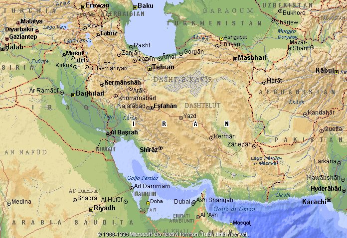
Tehran
-
Mashad
-
Isfahan
-
Tabriz
-
Shiraz
Islamic Republic of Iran's Flag & National Anthem
Structure of Government in Iran
The system of government in
Iran
is Islamic Republic which was founded after the
Islamic revolution of 19 79.
According to the constitution passed in a referendum in 1979,
Islamic principles underlie all cultural, social,
political and economic affairs of
Iran.
Leadership (Vali-e-Faghih) (Jurisprudential Guardianship)
The highest-ranking official in the Islamic Republic of Iran is the
leader or Vali-e-Faghih (Jurisprudential
Guardianship). Iran has 3 powers namely, the executive, the
legislative and the judiciary which are headed by
Vali-e-Faghih.
The leader or the leadership council is chosen by the Council of
Experts, the members of which are elected by
the direct vote of the people.
Executive Power
Iran's highest-ranking executive official and the head of the
executive power is the president who is elected by
people's direct vote for a four-year term.
The president must appoint a first vice-president and introduce his
cabinet to the parliament. Then, his cabinet
must get the parliament's vote of confidence. Iran's cabinet
includes 22 ministers. Ministry of Justice, Ministry
of Defence and Armed Forces, Ministry of Road and Transportation,
Ministry of Industries, the Ministry of
Housing and Urban Development, Ministry of Culture and Higher
Education, Ministry of Culture and Islamic.Guidance, Ministry of
Education, Ministry of Labor and Social Affairs, Ministry of
Agriculture, Interior Ministry,
Ministry of Mines and Metals, Oil Ministry, Ministry of Power,
Ministry of Post, Telegraph and Telephone,
Ministry of Cooperation, Ministry of Construction Jihad, Ministry
of Health, Treatment and Higher Education,
Ministry of Commerce, Ministry of Foreign Affairs, Ministry of
Economy and Financial Affairs and Ministry of
Information.
Legislative Power
Iran's legislative power, known as the Islamic Consultative
Assembly (Majlis) has 270 members who are
elected by people's direct vote for a four-year term.
In normal conditions, all the legislations passed by the Islamic
Consultative Assembly turn into a binding law
after being confirmed by the constitution's Guardian Council. This
council has 12 members, 6 of whom are
chosen by the leader and the other 6 by the Islamic Consultative
Assembly (Majlis). If the Guardian Council
and the Majlis do not agree on a law, the system's Expediency
Council, elected by the leader, gives the final
vote on it. Also, the system's general policies are determined
after the leader's consultations with the
Expediency Council.
Judiciary Power
The Judiciary is an independent power supporting the individual and
social rights of the Iranian citizens. The
highest-ranking judiciary official is the head of the judiciary who
is chosen by the leader for a five-year term.
The head of the Supreme Court and the chief Prosecutor are chosen
by the head of the judiciary after
consultations with the judges of the supreme court. Their term of
office is five years. According to the
constitution, the cases of political and press offences are
considered in open sessions of the court attended by
the jury.
Administrative Divisions
According to administrative divisions, Iran consists of 25
provinces, (in 1996 and 1997, the legislation of
forming
Qom,
Qazvin
and
Gorgan
provinces has been approved, if so,
Iran
will have 28 provinces. Also, other
legislations such as dividing
Khorasan
province into 3 provinces are now under
consideration). In 1995 Iran's.provinces had 252 counties 612 towns,
680 rural districts and 2212 villages.
Table for the General Specifications of the Provinces based on 1995
Division
Political Parties
According to the constitution, Iran's political parties are free
and a multi-party system rules the country. But,
due to some problems which arouse shortly after the Islamic
revolution, the activities of different political
parties were restricted in
Iran
and presently there is no active party in the
country. Recently in 1996, in the 5th
round of Majlis elections and also in the 7th round of presidential
elections in May 1997, the existence of
different views in the government and Majlis on how to run the
country was more evident than before.
It seems that the first ground for the formation of political
parties has been prepared with the formation of the
Group of the Servants of Construction who are moderates.
Armed Forces and the Military Service
It is obligatory for all Iranian men of over 18 to pass two years
of military service. Iran's armed forces include
the Islamic Republic of Iran's army and the Islamic Revolution's
Guards' Corps. (IRGC)
Each of them has air, naval, and ground forces. The Basij
paramilitary forces who are under the Islamic
Revolution's Guards' Corps include popular militia who are ready to
serve the country and also played a major
role in the Iraqi imposed war against
Iran.
International Organizations
In 1945, Iran joined the United Nations as one of its first members.
Iran is also a member of the following
organizations:
The Food and Agriculture Organization (FAO), the International
Atomic Energy Agency (IAEA), the
international Bank of Repair and Development (IBRD), the
International Civil Aviation Organization
(ICAO),the International Development Association (IDA), the
International Fund for Agricultural Development
(FAD).
The International fund Corporation (IFC), the International Labor
Organization (ILO), the International
Monetary Fund (IMF), the International Marine Organization (IMO),
the International Telecommunication.Union (ITU), United Nation's
Educational, Scientific and Cultural Organization (UNESCO).
The Universal Post Union (UPU), United Nation's Children's Fund
(UNICEF), World Health Organization
(WHO), World Intellectual Property Organization (WIPO), World
Meteorological Organization (WMO),
Customs Cooperation Council (CCC), Economic and Social Commission
for Asia and Pacific (ESCAP),
Organization of Islamic Conference (OIC), Interparliamentary Union
(IPU), Organization of Petroleum
Exporting Countries (OPEC),Economic Cooperation Organization (ECO),
United Nations Conference on
Trade and Development (UNCTAD), United Nation's High Commissioner
for Refugees (UNHCR), United
Nation's aid and employment institute for Palestinian Refugees in
West Asia (UNRWA), the Non-Aligned
Movement (NAM), Interstates Marine Consultation Organization (IMCO),
and the Group of 77 countries (G77)
Table for the General Specifications of the Provinces based on
1995 Division
Province Provincial Center Area Number Number Number Number
(Sq.Km) Connties Rural Districy Town Villages
East Azarbaijan Tabriz 44767 14 34 39 134
West Azarbaijan Urmieh 37599 12 28 22 103
Ardebil Ardebil 18451 6 17 14 62
Isfahan Isfahan 105805 17 37 60 116
Ilam Ilam 19086 7 17 15 36
Bushehr Bushehr 25360 8 17 13 36
Tehran Tehran 40836 11 33 38 103
Chaharmahal va Bakhtiari Shahr-E-Kord 14820 5 13 18 34
Khorasan Mashhad 315687 23 74 53 224
Khuzestan Ahwaz 66532 15 35 28 111
Zanjan Zanjan 23767 4 16 10 51
Semnan Semnan 91544 4 11 14 28
Sistan va Baluchestan Zahedan 181471 7 29 16 92
Fars Shiraz 120006 16 60 48 185
Kordestan Sanandaj 27858 8 21 12 78
Kerman kerman 185675 10 31 26 141
kermanshah kermanshah 23622 11 24 19 83
Kohgiluye va Boyer Ahmad Yasuj 13699 3 12 8 38
Gilan Rasht 14820 12 30 35 99
Lorestan Khoramabad 28560 9 24 10 81
Mazandaran Sari 46645 19 49 51 142
Markazi Arak 29530 8 15 18 60
Hormozgan BandarAbbas 65379 8 21 14 69
Hamadan Hamedan 19445 8 18 16 68
Yazd Yazd 696095 7 14 15 38
Total 1630569 252 680 612 2212
*Source:Statistical
Center of Iran.
Farsi
58%
Turkish 26%
Curdo 9%
Luri 2%
Baloch 1%
Arabo 1%
Turkmeno 1%
other 2%
|